Death Valley National Park
Trip Assistant
How Much Time?
The park is 3.4 million acres. Most people just drop in on their way between L.A. and Las Vegas. Unless it’s summer, that’s a huge mistake. With that said, if you don’t have a 4x4 and/or aren’t interested in hiking, you won’t need that much time. With a 4x4 and plenty of money for fuel, you could spend weeks here and not get sick of it.
At a minimum, spend one night to enjoy sunrise/sunset at Mesquite Flat Sand Dunes, and check out some of the highlights. There are quite a few overnight accommodations in the park and unlike most parks, camping is mostly first-come, first served (and usually available).
Need to Know
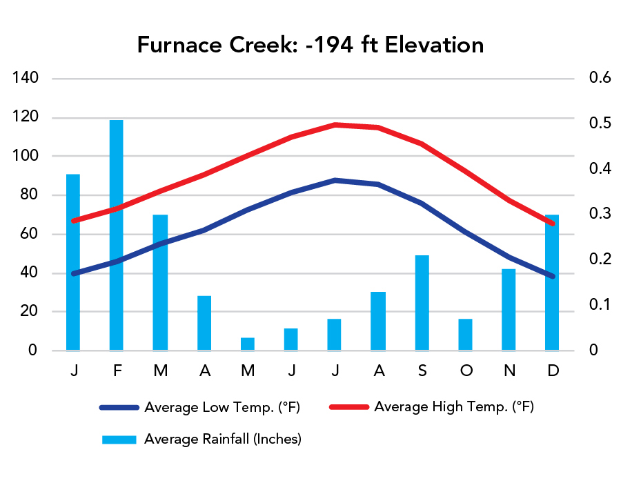
- Elevation varies from 282 feet below sea level to 11,049 feet. In summer, it can be over 100°F on the valley floor and in the 70s°F at the summit of Telescope Peak. Come prepared for varied weather, and be sure to acclimate to elevation.
- Gas, food, and water are available at Panamint Springs, Stovepipe Wells, and Furnace Creek.
- Superblooms depend on winter rain. If you’re hoping for flowers, check with the park about status.
Highlights
- Mesquite Flat Sand Dunes
- Badwater
- Zabriskie Point
- Eureka Dunes
- Dante's View
- Titus Canyon Road
- The Racetrack
Activities
- Off-Roading
- Hiking
- Backpacking
- Biking
- Horseback Riding
- Birdwatching
- Stargazing
Favorite Trails
Easy
Moderate Strenuous *Links to AllTrailsWhen To Go?
Weather
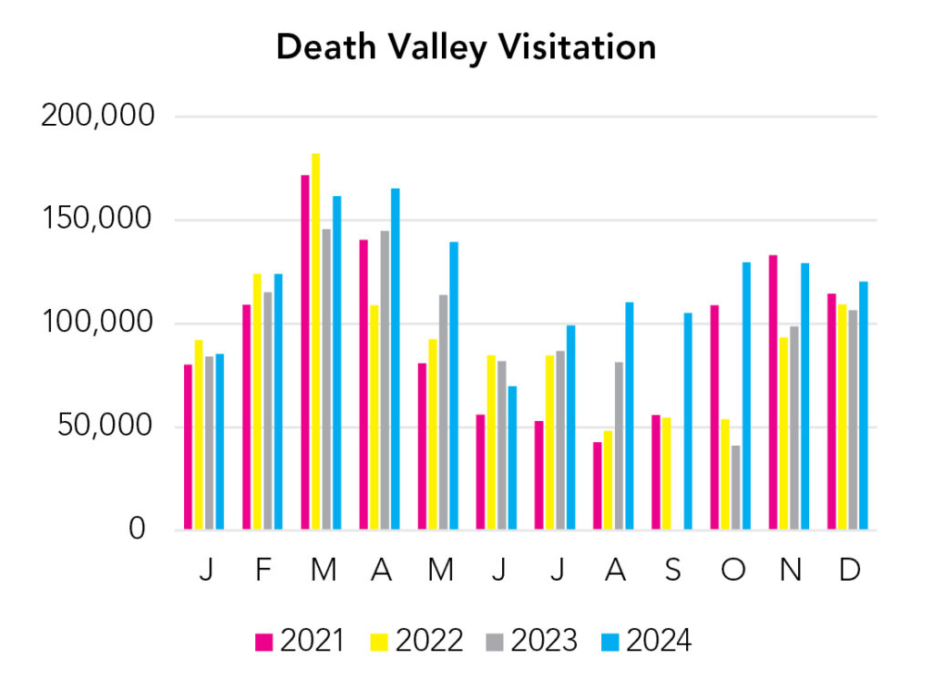
Visitation
Just go ahead and cross of summer as an option unless you want to come and climb Telescope Peak. Winters are comfortable in the lower elevations. Spring and fall are ideal. If there’s a super bloom, people visit from all around the globe. Remember the elevation difference here. Temperature decreases 3-5°F with every 1,000 feet of elevation gain.
Park Map Downloads
Road Trips
Helpful Tools
Below you'll see a Google Map to help plan road trips from the east (Las Vegas, NV), north (middle of nowhere, NV), west (Yosemite), and south (Joshua Tree). It’s a good start, but I’d highly recommend making your own. Google My Maps, Wanderlog, Roadtrippers, and TripIt are incredibly useful trip planning tools. Find what works best for you!
There’s much more to our country. Here’s another Google Map with points of interest across all types of public land.
For campers, here’s a Google Map with National Forest campgrounds. National Park campgrounds are difficult to reserve (there are about 200!). With nearly 5,000 national forest campgrounds, you can usually pull in and find a spot.
Highlights
- Parker Lake, June Lake Beach, Convict Lake, Big Pine Lakes), Palisades, Minarets, Whitney Portal, etc. / (Inyo National Forest)
- Alabama Hills
If you like this, please check out my books or Buy Me a Coffee (more likely some fuel 🙂