Everglades National Park
Trip Assistant
How Much Time?
With one day, start at Shark Valley. Take the tram or rent a bike to complete the 15-mile loop. If you just want to quickly gawk at some gators, walk along the west half of the loop, looking into the narrow waterway that parallels the road. It’s usually filled with gators (and birds). Then make the drive down toward Flamingo to hike Anhinga Trail.
With more time, you should consider joining a boat tour at Flamingo (or Thousand Islands), renting kayaks or canoes to paddle (Turner River near Thousand Islands) or something like West Lake near Flamingo. There is a Nike Missile Base here and the park offers tours. If that’s something you’re interesed in, check the park’s calendar of events.
Need to Know
- The best gator-spotting spots are Shark Valley, along Tamiami Highway (US-41), and Anhinga Trail
- Vultures are common at Anhinga Trail Parking area. Some visitors cover their vehicles with tarp to protect the rubber seals vultures like to pick at and eat.
Highlights
- Shark Valley
- Flamingo
- Whitewater Bay
- Nike Missile Base
- Thousand Islands
- Florida Bay
Activities
- Paddling
- Boat Tours
- Fishing
- Biking
- Hiking
- Birdwatching
Favorite Trails
Easy
Moderate- Shark Loop Road (can rent bike or get tickets for a tram too)
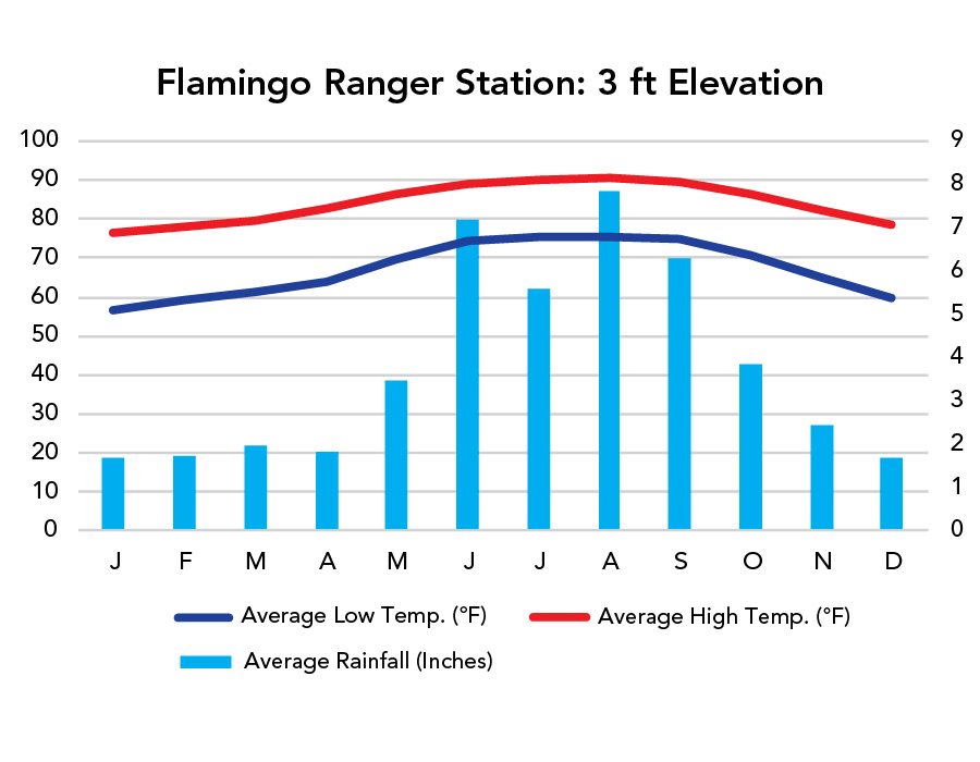
When To Go?
Weather
Visitation
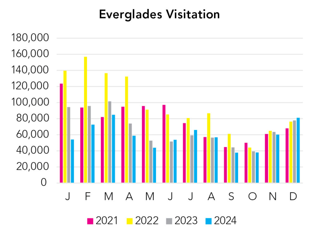
The park is busiest in winter, when northerners are looking to get away from winter weather. Summer is hot, but there’s plenty of water around to cool off in. Mosquitoes can be bad, particularly in the wet summer months.
Park Map Downloads
Road Trips
Helpful Tools
Below you'll see a Google Map to help plan road trips from the north (Congaree), Gulf, and south (Dry Tortugas). It’s a good start, but I’d highly recommend making your own. Google My Maps, Wanderlog, Roadtrippers, and TripIt are incredibly useful trip planning tools. Find what works best for you!
There’s much more to our country. Here’s another Google Map with points of interest across all types of public land.
For campers, here’s a Google Map with National Forest campgrounds. National Park campgrounds are difficult to reserve (there are about 200!). With nearly 5,000 national forest campgrounds, you can usually pull in and find a spot.
If you like this, please check out my books or Buy Me a Coffee (more likely some fuel 🙂