Hawaii Volcanoes National Park
Trip Assistant
How Much Time?
There’s a huge caveat with this park. If lava is flowing or churning in a lava lake somewhere, you do not want to miss that. No lava, no hurry to get here (in my opinion). Sure, Kilauea Iki is a fine trail, and if you’re willing to hike up to Mauna Loa, then you really have something (but you’ll need to be prepared for the cold and acclimated to elevation). Beyond that, there are so many exceptional attractions on this island I wouldn’t stress about trying to fit a bunch of time in to see Hawaii Volcanoes, again, unless the volcano is active (and I’d take the time to scour social media for recent images to see what others have seen—info can be misleading).
Need to Know
- For what was said to be the longest continuously active volcano, it’s been all fits and starts since 2018, including a once-in-a-lifetime Mauna Loa Eruption mixed in there. The Big Island is wonderful and lava is a great reason to make a spontaneous trip here. Monitor the park website and USGS website for information on current activity.
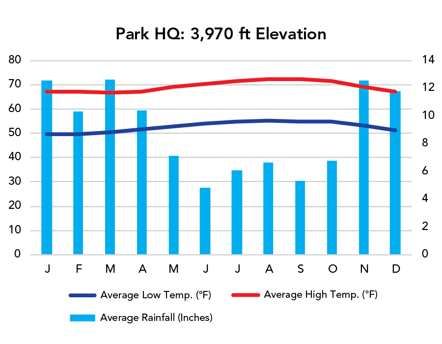
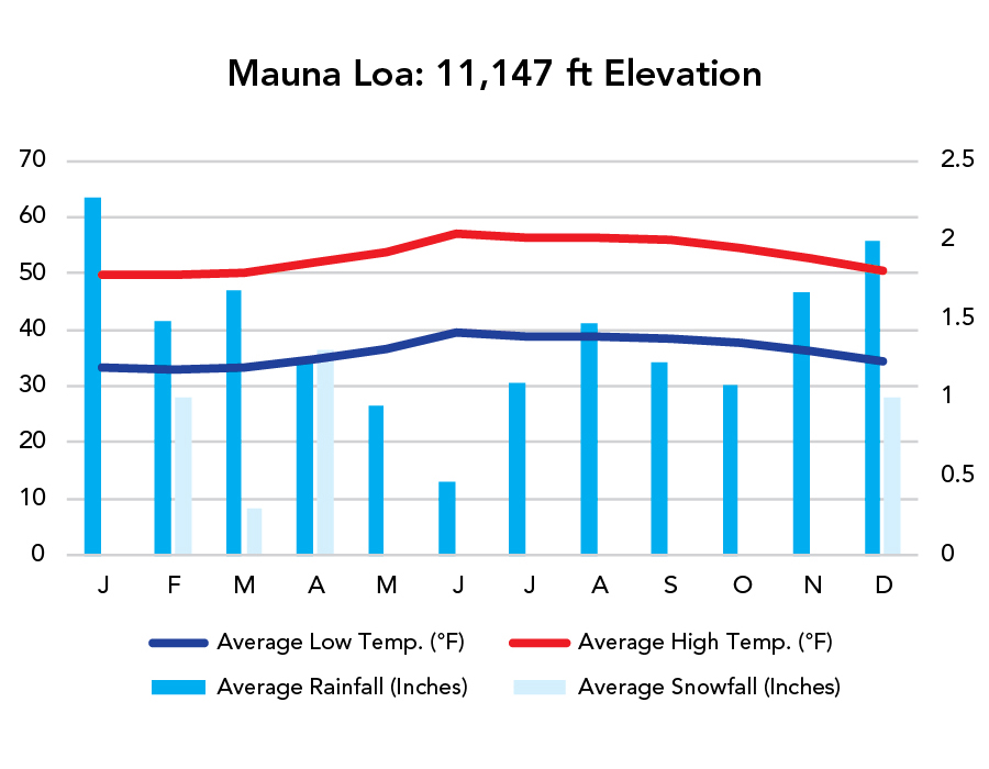
- Pay attention to elevation. Weather is consistent, but varies greatly from sea level to Mauna Loa (13,677 feet). It’s warm along the coast. Cool at the visitor center (3,980 feet), and can be snow-covered at Mauna Loa summit.
Highlights
- Kilauea
- Thurston Lava Tube
- Chain of Craters Road
- Mauna Loa
- Holei Sea Arch
Activities
- Lava Viewing
- Hiking
- Backpacking
- Biking
When To Go?
Weather
Weather
Visitation
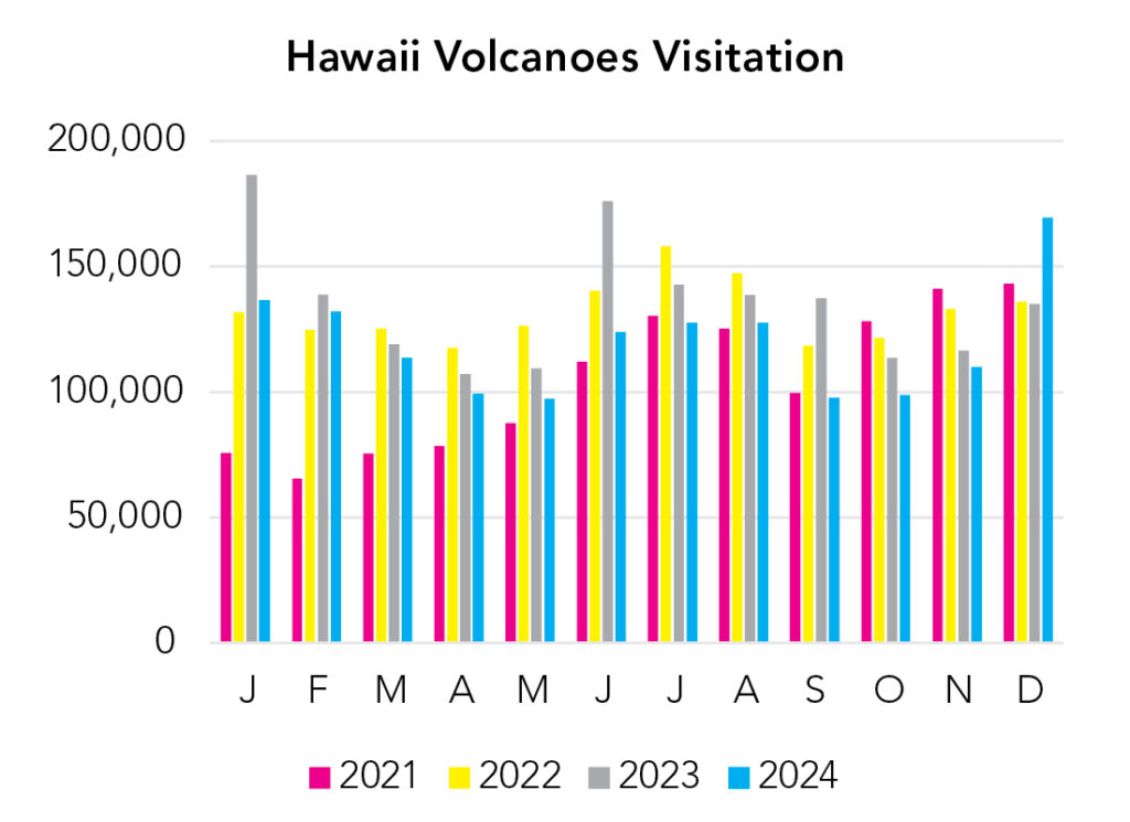
The Big Island is wonderful. It’s about 2.5 million acres (a little bigger than Yellowstone and 5x the size of Maui). And it receives about a half million fewer annual visitors than Maui, and more than a million fewer than Oahu. There should be good whale sightings from late fall through spring. Winter is typically wetter, but the difference isn’t all that significant. Temperature is fairly steady year-round. If there’s any standard visitation pattern it’s this: people from the northern U.S. visit in winter (with surges during severe winter storms) and people from the southern U.S. visit in summer.
Park Map Downloads
Road Trips
Helpful Tools
Below you'll see a Google Map to help plan a Big Island trip. It’s a good start, but I’d highly recommend making your own.
Google My Maps, Wanderlog, Roadtrippers, and TripIt are incredibly useful trip planning tools. Find what works best for you!
There’s much more to our country. Here’s another Google Map with points of interest across all types of public land.
For campers, here’s a Google Map with National Forest campgrounds. National Park campgrounds are difficult to reserve (there are about 200!). With nearly 5,000 national forest campgrounds, you can usually pull in and find a spot.
Highlights
- Peepee Falls (requires a swim, can be dangerous—nearby Rainbow Falls is a quick worthwhile stop too)
- Akaka Falls State Park
- Waipio Valley (the lookout is nice, but if you make some friends, you might be able to hike to Hiilawe Falls, which is tremendous, or backpack to Waimanu Valley)
- Pololu Valley (good hike to Honokane Nui Lookout)
- Mauna Kea Summit (sunset)
- Kua Bay (no sand in winter) or Makalawena (4x4)
- Keauhou Bay Manta Snorkel
- Honaunau/Two Step (you used to be free to swim with dolphins here)
- South Point (cliff jumping, do not jump if the surf is up) and Green Sand Beach (hike)
If you like this, please check out my books or Buy Me a Coffee (more likely some fuel 🙂