A trip here for most is a flight over or a quick stop at the sand dunes to touch the earth and get back in the air, flying back over a two million acre wilderness.
Need to Know
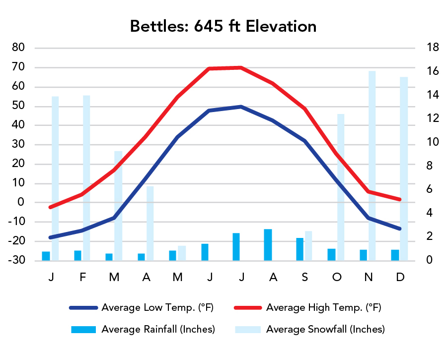
Kobuk Valley resides north of the Arctic Circle, enjoying a brief summer with 24-hour light.
It’s primarily reached by bush plane and explored by raft.
Each year a few hundred thousand caribou cross the park traveling between their breeding and calving grounds.
Lowlands are swampy permafrost making for difficult travel.
Highlights
Great Kobuk Sand Dunes
Onion Portage (caribou crossing)
Attractions and outfitters are pinned on the Google Map below. Expand the sidebar (top left corner) to see the data and select/deselect layers.
Activities
Backpacking
Paddling
Flightseeing
Favorite Trails
Kobuk Valley is a mostly trailless wilderness.
When To Go?
Weather
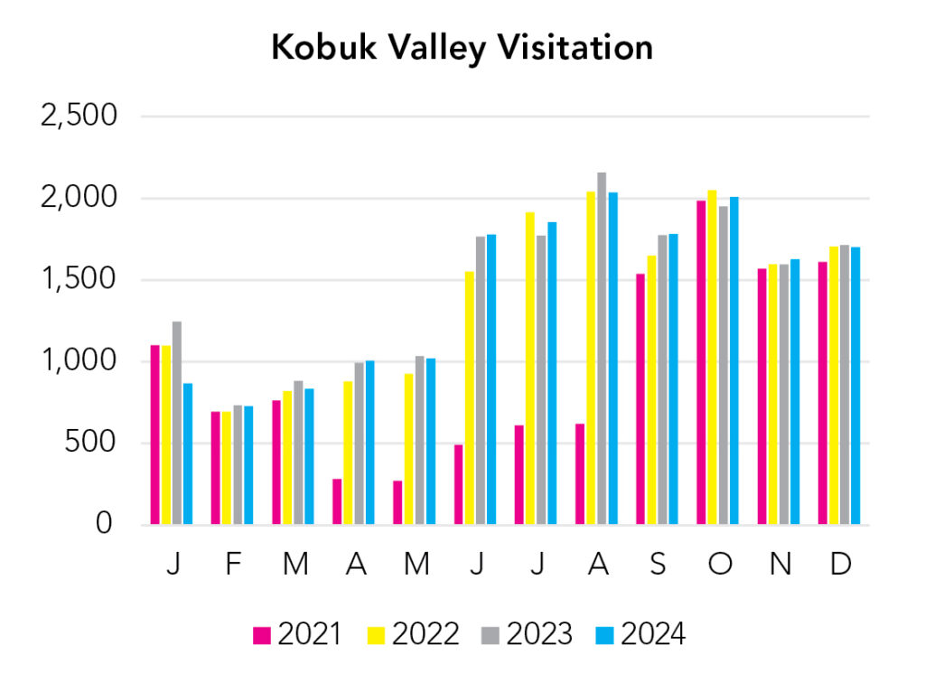
Visitation
You really only ought to be thinking about visiting in summer.