Mesa Verde National Park
Trip Assistant
How Much Time?
Touring Mesa Top Loop, Cliff Palace Loop, and Wetherill Mesa in a day is doable. If you want to read every sign and see every site, then you’d need a bit more.
The main contingency in amount of time spent here is cliff dwelling tours. (Reservations are required.) They’re all worth doing and each one takes about 1-2 hours.
Personally, I feel like you’re better off trying to maximize time in the Rockies to the east or southern Utah to the west.
Need to Know
- Reservations are required for cliff dwelling tours.
- None of the cliff dwelling tours are easy. You’re hiking to a settlement built into a cliff’s alcove. They all involve a ladder or two and a fair amount of elevation gain.
- Spruce Tree House can be toured on your own, when it’s open (unfortunately it’s been closed for years).
Highlights
- Cliff Palace
- Balcony House
- Long House
- Step House
- Square Tower House
- Spruce Tree House
- Sun Temple
- Kodak House
- Rock Canyon Tower View
Favorite Trails
Easy
- Montezuma Valley Overlook
When To Go?
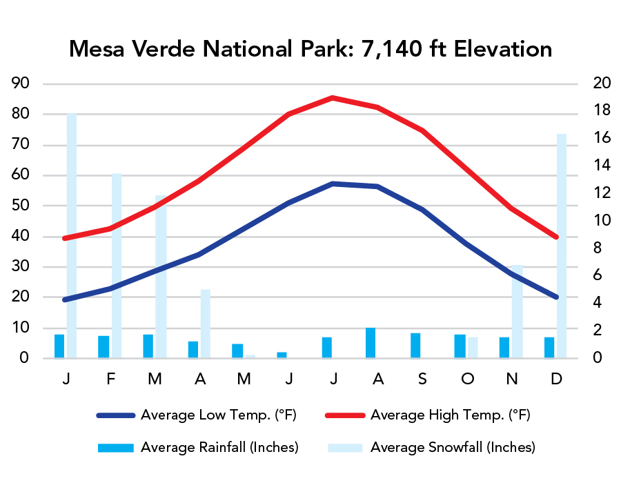
Weather
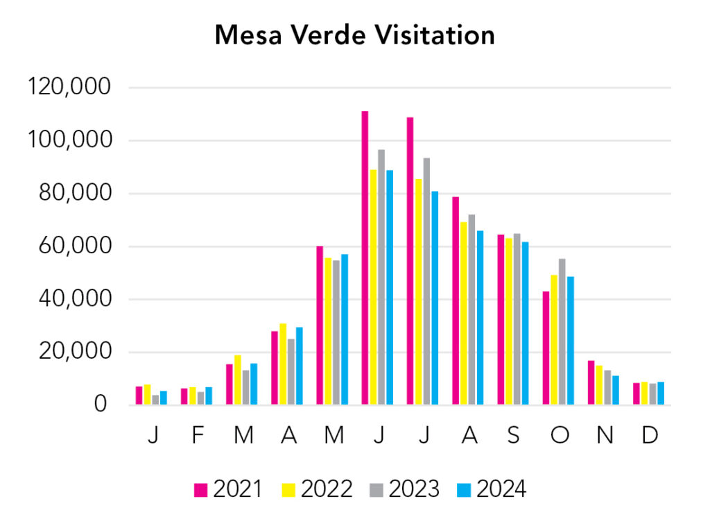
Visitation
While the park stays open all year, cliff dwelling tours understandably stop for winter. They’re typically offered from late May through mid-September. Tours are definitely the highlight, but if you’re in the area during the offseason, I feel like a quick stop in is worth the detour.
Park Map Downloads
Road Trips
Helpful Tools
Below you'll see a Google Map to help plan road trips from the east (Great Sand Dunes), north (Black Canyon of the Gunnison), west (Canyonlands), and south (Petrified Forest). It’s a good start, but I’d highly recommend making your own. Google My Maps, Wanderlog, Roadtrippers, and TripIt are incredibly useful trip planning tools. Find what works best for you!
There’s much more to our country. Here’s another Google Map with points of interest across all types of public land.
For campers, here’s a Google Map with National Forest campgrounds. National Park campgrounds are difficult to reserve (there are about 200!). With nearly 5,000 national forest campgrounds, you can usually pull in and find a spot.
Highlights
Not-so-much the Mesa Verde area, but everywhere around it is awesome. I don’t know enough yet. Google Maps is your friend!
If you like this, please check out my books or Buy Me a Coffee (more likely some fuel 🙂