Sequoia & Kings Canyon National Parks
Trip Assistant
How Much Time?
This is another park you cannot generalize how much time to spend here. If you love to hike/backpack, this is some of the finest backcountry wilderness on the planet. If you’re sticking to the roads, there really isn’t that much to see (although the drive down to Roads End is spectacular).
There’s very little easily-accessible High Sierra. Outside of Moro Rock (and Mineral King), you must earn the views. Driving, plan a full day (it will likely be busy and hot in summer). Hiking, target Lakes Trail, maybe another day at Mineral King, and, better yet, head around to the Eastern Sierra to get a look at Mount Whitney.
Need to Know
- Reservations are required for camping.
- Summer is very busy and hot in the foothills. Spring brings wildflowers and charged up waterfalls. Fall brings cooler weather and small crowds.
- There is a free summer shuttle.
- You can do a more pampered backpacking trip thanks to Sequoia Camp and Bearpaw Camp.
- Marmots have been conditioned to chew on rubber car parts at Mineral King.
Highlights
- Giant Forest Museum
- Crescent Meadow
- General Sherman
- Grant Grove
- Tunnel Log
- Roads End
- Crystal Cave
- Whitney Portal (Inyo NF)
Activities
- Cave Tours
- Hiking
- Backpacking
- Rock Climbing
- Horseback Riding
- Cross-country Skiing
- Snowshoeing
- Sledding
Favorite Trails
Easy
Moderate Strenuous Extreme *Links to AllTrailsWhen To Go?
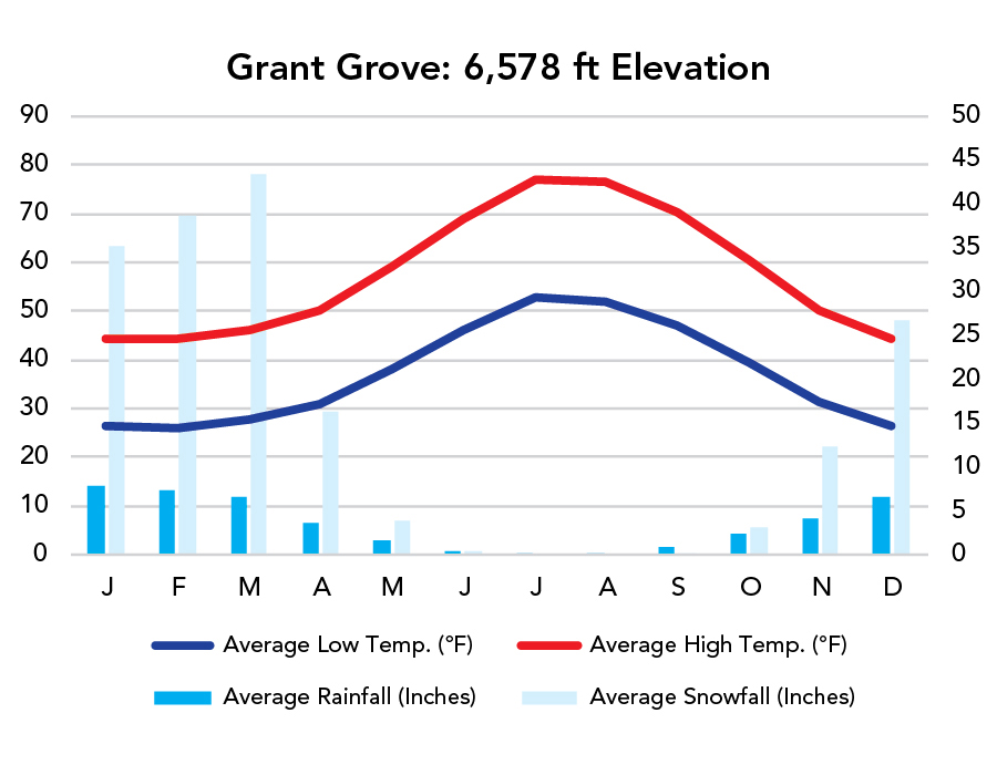
Weather
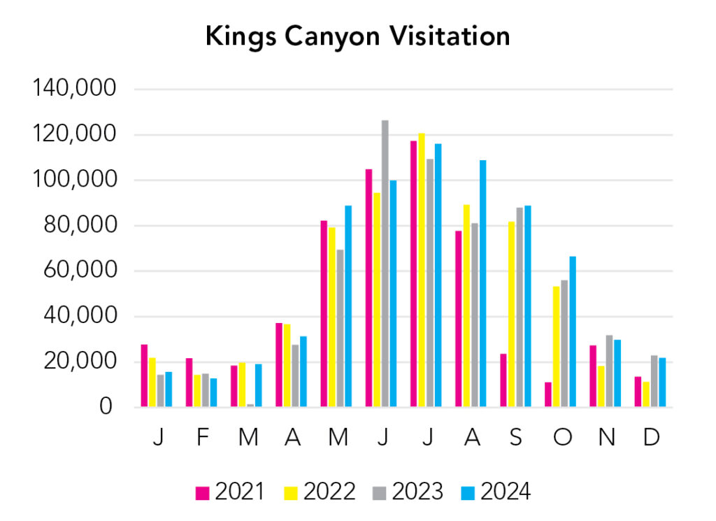
Visitation
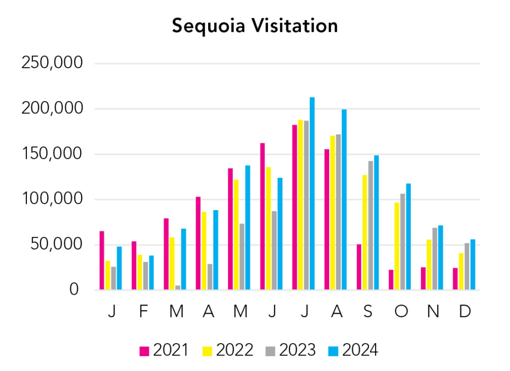
Visitation
The park is open year-round, and the massive sequoia trees are glorious in the snow, and you can hike/snowshoe/cross-country ski to Pear Lake, but the vast majority of visitors arrive in summer, when it’s hot in the foothills and comfortable in the high country. Spring is great for waterfalls. Fall is excellent for hiking/backpacking. Remember the elevation difference here. Temperature decreases 3-5°F with every 1,000 feet of elevation gain.
Park Map Downloads
Road Trips
Helpful Tools
Below you'll see a Google Map to help plan road trips from the north (Yosemite), west (Pinnacles), and south (Joshua Tree). It’s a good start, but I’d highly recommend making your own. Google My Maps, Wanderlog, Roadtrippers, and TripIt are incredibly useful trip planning tools. Find what works best for you!
There’s much more to our country. Here’s another Google Map with points of interest across all types of public land.
For campers, here’s a Google Map with National Forest campgrounds. National Park campgrounds are difficult to reserve (there are about 200!). With nearly 5,000 national forest campgrounds, you can usually pull in and find a spot.
Highlights
Outside of Moro Rock and Mineral King, Sequoia and Kings Canyon don’t serve up many jaw-dropping High Sierra views. Most require long hikes or tedious drives on unpaved roads. You could do that, earning those views, but you could also drive around the mountains to the Eastern Sierra. Places like Convict Lake and Alabama Hills are stunning, accessible, open year-round, and much less crowded than Generals Highway. And you can actually get a good look at Mount Whitney!
If you like this, please check out my books or Buy Me a Coffee (more likely some fuel 🙂