Theodore Roosevelt National Park
Trip Assistant
How Much Time?
You definitely could get a pretty good idea of what this region of the country is like by driving through the South and North units in a day, stopping at a few overlooks, enjoying the wildlife, and maybe doing a couple quick hikes, but I’d suggest spending one night at each main unit. This way you can do some more serious hiking. With a little more time, then you start thinking about making the drive to Elkhorn Ranch (it’s just ruins), or maybe paddling the Little Mo, or racking up more miles on the park’s underrated trail network.
Need to Know
- Wild horses are seen in the South Unit.
- The North and South units are great for wildlife viewing, but the south tends to be better (larger herds + more roads).
- Maltese Cross Cabin is open via ranger tour in summer, and self-guided the rest of the year.
Highlights
- Scenic Loop Drive (South)
- Beef Corral Bottom (South)
- Maltese Cross Cabin (South)
- Prairie Dogs
- Scenic Drive (North)
- River Bend Overlook (North)
- Cannonball Concretions (North)
- Oxbow Overlook (North)
Activities
- Hiking
- Backpacking
- Horseback Riding
- Paddling
- Biking
- Fishing
- Cross-country Skiing
- Snowshoeing
Favorite Trails
Easy
Moderate Strenuous *Links to AllTrailsWhen To Go?
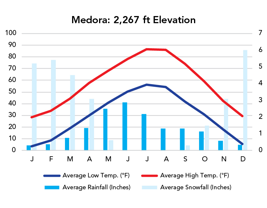
Weather
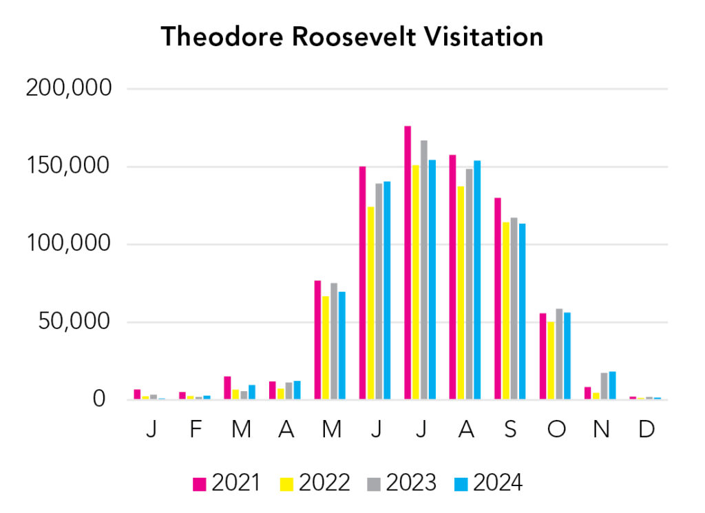
Visitation
If you want a beautiful place to yourself, this is a good choice in April. It’ll be muddy but warm, with excellent wildlife watching.
Park Map Downloads
Road Trips
Helpful Tools
Below you'll see a Google Map to help plan road trips from the east (Voyageurs), west (Glacier), and south (Wind Cave). It’s a good start, but I’d highly recommend making your own. Google My Maps, Wanderlog, Roadtrippers, and TripIt are incredibly useful trip planning tools. Find what works best for you!
There’s much more to our country. Here’s another Google Map with points of interest across all types of public land.
For campers, here’s a Google Map with National Forest campgrounds. National Park campgrounds are difficult to reserve (there are about 200!). With nearly 5,000 national forest campgrounds, you can usually pull in and find a spot.
Highlights
If you’re continuing west, there’s a lot of incentive to hustle to the Rockies. Things start to get real interesting!
If you like this, please check out my books or Buy Me a Coffee (more likely some fuel 🙂