Voyageurs National Park
Trip Assistant
How Much Time?
This is not a show up and have fun kind of park. You need a plan, and, preferably, a boat. More than one-third of the park is water and most of the land is only accessible by boat (unless it’s winter and the lakes are frozen). Paddling is great at nearby Boundary Waters, but here, the lakes are huge and you’re better off with a motor. (You have some pretty good paddle options from Ash River or you can find outfitters to drop you off deeper in the park.) Back to boating. If you’re uncomfortable or uninterested in renting or bringing a boat, you can join boat tours. And that’s a decent alternative, but it’s not nearly the same thing as the freedom of boating around these lakes and camping at very secluded lakeside campsites under the stars.
Need to Know
- You really need to rent a boat to get to know this park.
- North Canoe Voyage ranger programs are good too, but not the same sort of freedom.
- Boat tours are also offered.
- If you rent a boat, know what you’re getting into. Houseboats are huge and slow, and you have to tow another boat. Whatever you rent, bring a GPS or make sure the boat has one on its depth finder.
Highlights
- Grassy Bay Cliffs
- North Canoe Voyage
- Boat tours
- Anderson Bay Overlook
- Ice Roads
- Kettle Falls Hotel
Favorite Trails
It’s a boating park, but you can hike Oberholtzer Trail from Rock Harbor or Blind Ash Bay Trail at Windigo.
When To Go?
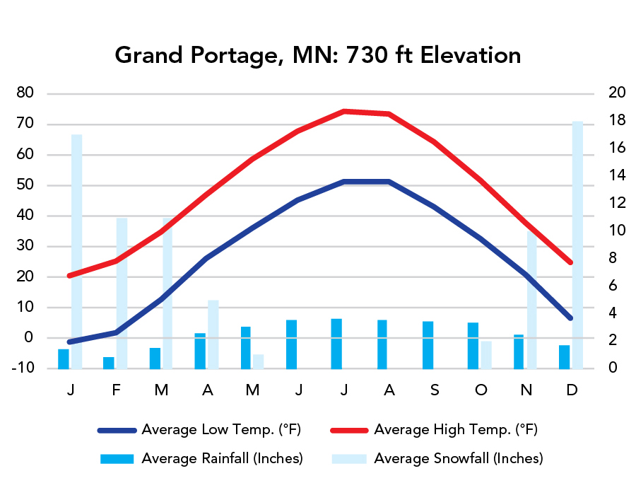
Weather
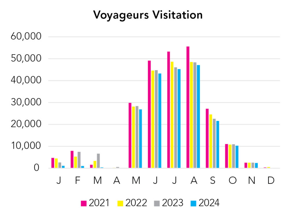
Visitation
Voyageurs is all about the water, so summer is best.
Park Map Downloads
Road Trips
Helpful Tools
Below you'll see a Google Map to help plan road trips from the east (Grand Portage, MN), west (Theodore Roosevelt), and south (Minneapolis, MN). It’s a good start, but I’d highly recommend making your own. Google My Maps, Wanderlog, Roadtrippers, and TripIt are incredibly useful trip planning tools. Find what works best for you!
There’s much more to our country. Here’s another Google Map with points of interest across all types of public land.
For campers, here’s a Google Map with National Forest campgrounds. National Park campgrounds are difficult to reserve (there are about 200!). With nearly 5,000 national forest campgrounds, you can usually pull in and find a spot.
Highlights
Western Minnesota/Eastern Dakotas are not great
If you like this, please check out my books or Buy Me a Coffee (more likely some fuel 🙂